Yesterday I delivered the 205 to Scranton/ Wilkes-Barre for the new owner to conduct a pre-buy inspection. I'm sure everything will be fine so that was likely my last flight in N8104Z.
 |
| N8104Z, 1964 Cessna 205 (IO-470) Ready to leave KVVS |
 |
| I can't say I will miss this hangar -- the doors are insanely hard to open and close! |
 |
| A little fuzzy -- it was about 20 degrees out, Janet was cold, and I was running late! |
 |
| The confluence of the Susquehanna (North and West Branches) |
 |
| Nice tailwind! |
 |
| We stayed here Wednesday night! |
He had to shuttle me back west, though, so I landed at KWAY and bid the
bird farewell.
 |
| On the ramp at KWAY |
 |
| Leaving KWAY (this is 1000' down the runway) |
 |
| Nice climb (200' up halfway down the runway) |
Then I headed over to John Strope's hangar where my
airplane -- N24286 -- was sitting, looking nearly ready for flight.
 |
| Waiting to Fly |
 |
| Original Panel and Gauges |
But first I had to put all the inspection plates, floorboards, and wing root fairings back in place. Re-assembling the whip antenna took the longest -- it takes three hands and you have to reach over the wing, so its not the easiest job. We also finished hooking up the air hoses and reset the cowling (it consists of four flexible aluminum pieces that have the be coaxed into position).
After two hours we pushed it out and started it up. It took a few throws but she finally came to life, running smooth and strong (relatively speaking, of course!) I took her around the pattern twice and all was in order. I went round on the first landing as I was a bit fast. I shouldn't have worried, though, as on the next landing I learned how soft the ground was! It was still fairly moist from rains earlier in the week.
We put her into a temporary hangar, hooked up the Deuce engine heater Bill had given me, and drove up to Washington, PA where Janet nd I spent the night at the local Hampton Inn.
We rose early this AM and headed back south on I-79 to Waynesburg. By the time I pulled the airplane out and had her loaded up and ready to fly it was 0750. I used my proven starting technique: 4 shots prime, rotate the prop 6 times (to evenly distribute fuel in all cylinders), mags hot, throw prop. On the second throw she started up. The cold-running chugga-chugga was replaced by an even putt-putt-putt. John said some of the valves were way out of adjustment. They'll all set to factory specs now.
I closed the hangar doors, untied and un-chocked, and climbed aboard. It was not quite as cold this morning as it had been yesterday -- clear evidence winds wee from the south. The high pressure that dominated our area was about to move east.
I checked flight controls while taxing to runway 27. The radio seemed to work but it was quiet. Runup had the normal 25 RPM drop on each mag and slight drop with carb heat. I checked the trim, announced that I was taking off to whoever might be listing, added throttle, and felt the airplane start rolling.
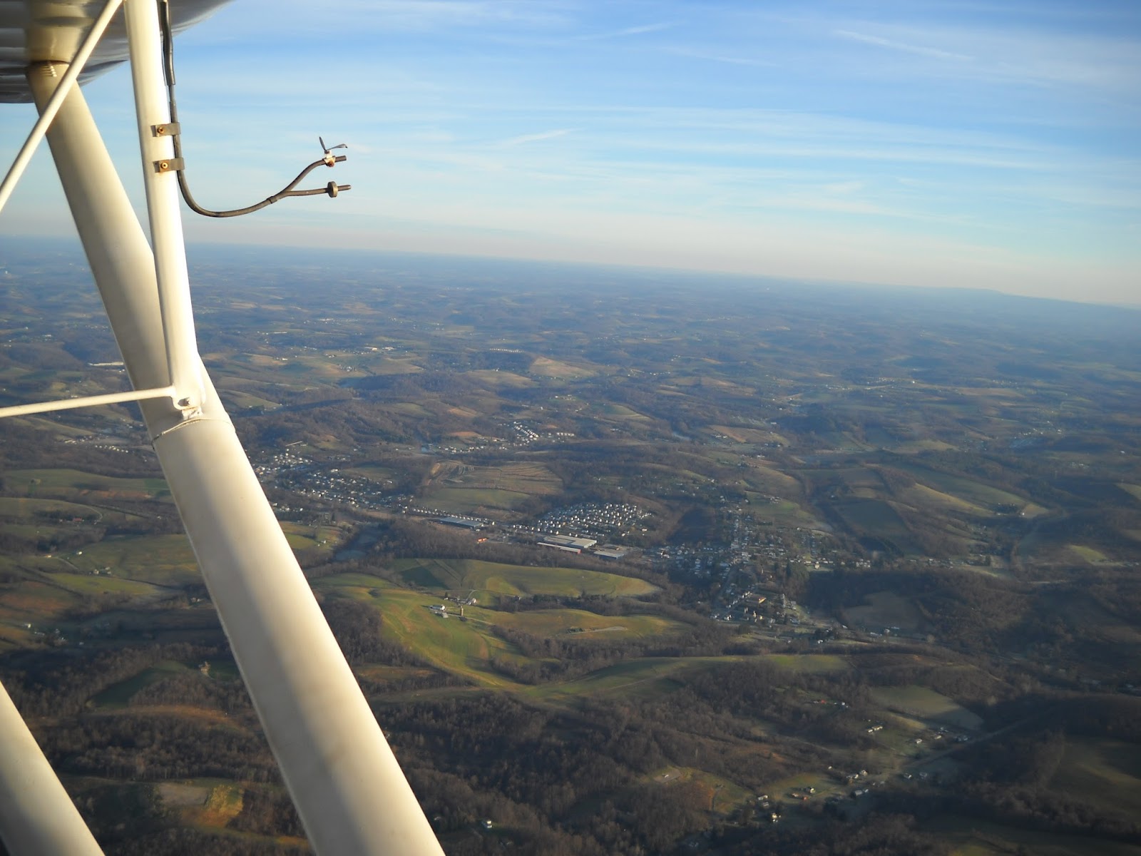
The tail came up and soon the earth was dropping away. I saw Janet watching from the car so I gave a little wing waggle. RPM indicated about 2300 -- as expected on takeoff. I flew past I-79, then began the left turn for downwind -- so far so good. A quick check in level flight indicated 2550 RPM and 85 MPH. Good, let's go.
 |
| New Salem, Fayette County, Pennsylvania |
I set up an on-course heading of 100 degrees to correct for the southerly winds and maintained a steady climb at 65 MPH. Soon Fayette county was underneath. I spotted our house in New Salem just under the left wing. Soon Uniontown was ahead and I knew that the wind correction angle was too much. I headed towards the gap in the ridge near Connellsville and leveled off at 4000'. The engine was running steady and airspeed was indicating 82-84 MPH in level flight with 2450 RPM.
 |
| It's been 20 minutes, 57 seconds since startup. I took off 15 minutes ago and am still climbing to clear the ridges east of Connellsville. |
 |
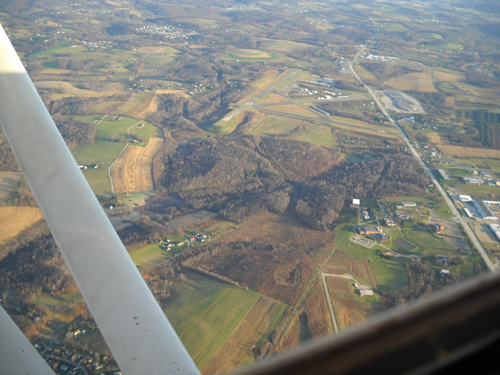
| Connellsville Airport (KVVS) from 2100' AGL. Route 119 is just to the east |
 |
| The Youghiogheny River runs through this gap in Laurel Ridge |
The miles were ticking by and I was ahead of schedule. The winds were more westerly than forecast which predicted a southerly flow so I had to keep adjusting back to a 090 heading. Soon Somerset came in view. I listened to the AWOS and winds were 240 at 5, so I planned on landing on the pavement for the first time in many months.
I descended at a steady 90 MPH and entered the pattern at 3300'. I turned base to final and clearly the winds were significant up here. I added power to reach the field, and gently touched down on runway 25 and had to taxi a while to the fuel pump The lineman helped me out but there was more fuel in the tank than I realized and so it only took 4.15 gallons, with 1.5 flowing over the cowling. Oh well.
 |
| Ready to prop at Somerset County Airport. The aluminum tape below to prop helps reduce the cooling blast on the oil pan, allowing the engine to run warmer and produce more heat for the cabin! |
The lineman said he couldn't give me a prop, so I pulled it over to the fence, tied the tail to a fence post, chocked the wheels, and primed it once. A quick flip and she was rumbling strong, but the throttle was a bit more advanced than I planned and I had to quickly reach in and throttle back -- she was ready to go!
Winds were 240 @ 10 now and after the long taxi down and a quick runup we were quickly airborne. I turned east not far past the airport edge and continued climbing. There were a couple of more high ridges to the east, the first with dozens of tall windmills. A steady climb at 70 MPH had me at 4500 feet in smooth air enjoying a significant tailwind. I turned on the Garmin 496 on the shelf behind me and it soon indicated a groundspeed of 100.1 knots!
But I didn't need the GPS today -- the air was spectacularly clear, with just a hint of haze.
 |
| The Flight 93 Memorial site, just east of Somerset. |
 |
| Miles of valleys and ridges |
 |
| Shawnee State park (Just west of Bedford, PA) |
 |
| The mighty Lycoming O-145-b2, built in 1940, pumping out 65 horses (or so) at 2500 RPM.... |
 |
| Bedford, PA and the Pennsylvania Turnpike |
 |
| Bedford Airport (KHMZ) |
 |
| Forested Ridges east of Bedford, PA |
 |
| 2450 RPM, 83 MPH at 4200' MSL 29 minutes after startup at Somerset |
 |
| The Sideling Hill Service area on the Pennsylvania Turnpike (I've stopped here far too many times...) |
 |
| The easternmost tunnels on the Pennsylvania Turnpike |
 |
| The last ridge, Blue Mountain |
 |
| The Pennsylvania turnpike heading northeast towards Harrisburg. My route was directly east over York, PA |
I maintained my heading and intercepted the turnpike a bit south of the planned point, so I followed it north and then turned to 110 degrees for a straight line home. I was going to descend to 2500' but the tailwinds were up here, so I stayed at 3500' until the Susquehanna river, just east of Three Mile island.
I could see Lancaster city in the distance and pointed the nose down a bit, maintaining a steady 90 MPH. That ended when I reached 2000' -- it was very rough, and I was working full time to keep the wings level. The winds were from 210 or so up here and rolling up over the hills along the north. I climbed back up to 3000 where it was still relatively smooth.
I switched to Smoketown CTAF and heard a few folks in the pattern. I lined up with Route 30 which runs east north of Lancaster and spotted the runway about 12 miles away.
I reduced power to 2000 RPM and trimmed nose down to establish a steady descent to pattern altitude. The air was unstable, but not as rough as near the river. I kept it in tight, did a slipping left hand turn and rolled out lined up for 28. I offset to the left a bit once I had the field made and aimed for a spot just past the ditch on the eastern edge of the field.I was a bit fast on final but getting tossed around pretty good until I levelled off about 5' above the grass. A smooth touchdown followed by a steady deceleration and meant I was home. Whew.
 |
| Red line is landing distance on the grass at S37 (500 feet) |
I passed a couple of guys who watched me roll by the fuel pump, crossed the runway and taxied over to the new hangar and shut her down.
 |
| Centerville and Route 30 near Lancaster |
 |
| City of Lancaster, Pennsylvania |
 |
| Ready to be put away |
 |
| See ya next time! |
 |
| Smoketown Airport (S37), East Lampeter, PA |
2.3 hours, 185 nautical miles traveled, 7 gallons of fuel (not bad!). The battery powering the handheld worked fine (I did a radio check 10 miles out from Smoketown and was Loud and Clear). I had the Garmin 496 on after I left Somerset and checked it to confirm position and groundspeed every 15 minutes or so and it used about 10% of its charge. I had a solar trickle charger on board but didn't need it.
This was my longest flight in the Chief and while I'm gad I did it, I'm not anxious to fly that far in this old bird again. It's cramped, noisy, and gets tossed around with the slightest turbulence. And it's a bit worrisome to fly over miles of desolate forest tracts with a single engine that has failed in flight once before.


Dan,
ReplyDeleteSafe flight! I thought you had posted about moving the plane to smoketown. Look forward to catching up.
Thanks, Gary!!
ReplyDeletevery nice write up...really liked the pics.
ReplyDeleteExcellent journal and photos!
ReplyDeleteOutstanding write up.
ReplyDeleteIt was good to see you yesterday at Smoketown !!!
(curtis & rick)